Wisconsin County Maps
Home » Wisconsin
Wisconsin has 72 counties, a population of more than 6 million people, about 783 zip codes and 612 public school districts. Those counties vary widely in population, school enrollment, zip code coverage and local boundary structure. Milwaukee County has the largest population in the state, while Menominee County has the smallest. Browse the map, population, zip codes, school districts, subdivisions and county list sections below to explore further. Or, simply start typing in the box below to go directly to that county.
Interactive Wisconsin County Map
This Wisconsin county map preview highlights population-by-county context, ZIP code coverage, school districts, and local boundary structure. Full statewide and county-level data packages are available when you need complete downloadable datasets. Click or tap any county to view its maps, trends and data.
Start with a free preview, or go straight to the full Wisconsin dataset .
Wisconsin Population By County
Wisconsin's population was over 6 million in 2020, up 206,732 (3.64%) residents from 2010. Milwaukee County had the largest population in the state with 939,489 people. Dane and Waukesha Counties also stand out as major population centers. Menominee County was the least populated area in Wisconsin with only 4,255 residents. The table below compares Wisconsin county populations and recent population trends.
The Most Populated Counties In Wisconsin
| County | Population | Trend (2010-2020) |
|---|---|---|
| Milwaukee County | 939,489 | ▾ 0.87% |
| Dane County | 561,504 | ▴ 15.05% |
| Waukesha County | 406,978 | ▴ 4.38% |
| Brown County | 268,740 | ▴ 8.36% |
| Racine County | 197,727 | ▴ 1.19% |
| Download all county population data | ||
County populations reflect the latest state serving context (2020).
Wisconsin County Map With ZIP Codes
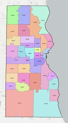
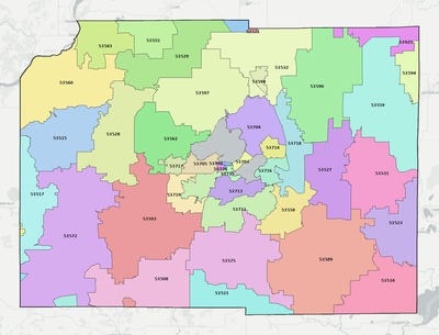
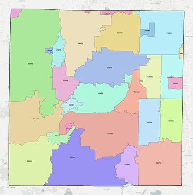
Wisconsin has about 783 zip codes statewide. Milwaukee County contains the most zip codes, with 36. County-level zip code maps give a faster and clearer way to understand local coverage as zip boundaries can span county and municipal lines. The maps below highlight a few Wisconsin counties.
Wisconsin School Districts By County
Wisconsin has 612 public school districts with 1,104,743 students enrolled as of 2024. Dane County has the highest district count in the state. Milwaukee County has the largest total school enrollment. Dane County posted the largest recent enrollment gain. The table below compares county level school district totals and recent enrollment trends across the state.
Largest School Districts in Wisconsin
| County | Districts | Enrollment | Trend |
|---|---|---|---|
| Dane County | 24 | 88,273 | ▴ 0.51% |
| Marathon County | 16 | 32,338 | ▾ 1.16% |
| Milwaukee County | 14 | 110,546 | ▾ 1.79% |
| Rock County | 14 | 34,653 | ▾ 1.61% |
| Dodge County | 14 | 19,898 | ▾ 1.39% |
| Download all school district data | |||
School district enrollment and trend values reflect the most recent state-level context (2024).
Wisconsin County Map With Subdivisions
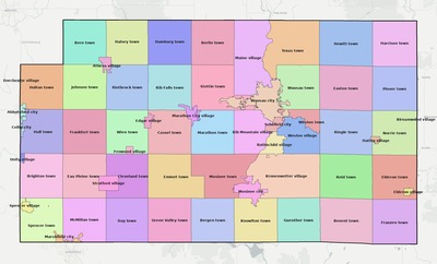
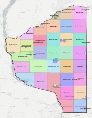
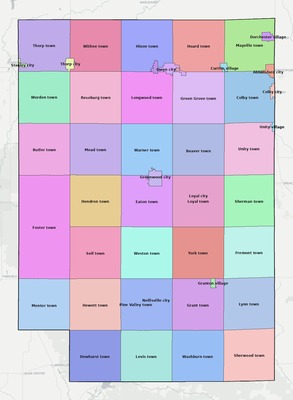
Wisconsin has about 1,925 local subdivisions statewide. These boundaries add another layer of detail within counties and help show how local subdivision lines fit inside county boundaries. The previews below highlight a few Wisconsin counties with subdivision map coverage.
Get the Full Wisconsin Data Package
The sections above provide a preview of Wisconsin county maps and county-level data. The full package includes complete statewide coverage with ready-to-use files for mapping, planning, and analysis.
Everything is organized to save hours of data collection, cleanup, and integration work.
- County map exports and boundary coverage for every county in Wisconsin
- Statewide GIS layers for ZIP codes, subdivisions, school districts, roads, water, and political boundaries
- Population, demographics, school, housing, and trend context aligned across counties
- Database files, map-ready exports, and documentation designed for faster research workflows
Includes GIS layers, maps, demographics, analytics, database files and planning tools.